Rural GIS Mapping System
1.Executive Summary
Tribandtech professionals conceived and designed in collaboration with IIT Madras and built an elegant software solution that makes it easy to capture village level natural resource data for usage and analysis in the entire state of Andhra Pradesh. The solution helps in implementation of schemes focused on conserving natural resources such as water bodies, agricultural resources etc. as well as supervising with effective management and monitoring. The focus has been the development of a solution that can easily be used by village level users, even school children with limited training. The application captures digital multi-media data like photographs, audio and video including GIS mapping through mobile phones using GPS and map technologies overcoming the barriers of language and communication.
2.Introduction
It is a well known fact that all village data that is collected ranging from demographic data to farm or filed level data including those of natural resources is being done manually on paper based forms. Such collected data is then fed into computer systems such as Excel spreadsheets or Word document. This approach has traditionally led to many major issues and problems such as:
Manual effort of handling paper including the storage and transportation costs. Paper also gets torn / damages easily rendering the hard work of data collection futile.
Preservation of papers for a long time is also a challenge as it is not easy to track / search and retrieve relevant paper sheets or files, unless of course one organizes the papers meticulously in Cabinets/ Files/ structure with proper foolproof numbering identification system.
Paper based data cannot be analyzed and viewed more than the way the data has been collected in its original form.
Even if data entry is done it is only done manually by somebody else which is more error prone.
As the volume of data collection keeps growing the challenges of maintaining / updating, analyzing the data becomes even more challenging. So,
How can authentic useful data be collected in a more efficient manner?
How can the solution be highly scalable easily and allow for almost near real-time data view and analysis by authorized users anywhere, anytime?
How can the data be collated at a centralized server that would facilitate a dashboard view of holistic data and allow for generation of multiple reports?
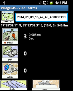
Keeping the above issues in mind, Tribandtech professionals conceived and designed in collaboration with IIT Madras and built an elegant software solution that makes it easy to capture village level natural resource data for usage and analysis in any Indian state. The solution helps in implementation of schemes focused on conserving natural resources such as water bodies, agricultural resources etc. as well as supervising with effective management and monitoring. The focus has been the development of a solution that can easily be used by village level users, even school children with limited training, so that data collection can be done at multiple locations simultaneously. The application captures digital multi-media data like photographs, audio and video including GIS mapping through mobile phones using GPS and map technologies overcoming the barriers of language and communication.Length and area calculated and displayed next to the location. Length is calculated when the no of locations is 2 or more and area is displayed when the no of locations is 3 or more. The distance is shown in km and area in acres. User can also modify the display and units using the Configuration file options.
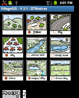
Hierarchical Screens for Layers. The main menu contains all the top-level Layers described using the L*_Name Layer Icons. If there are icons given in the format as L*_L*_Name, then the Sub Layer is created using these set of icons. This can be nested as deep as the user would like. A stack structure is used to display the Layers and Sub-Layers.
3.The Solution
Triband's Rural GIS Mapping application is a GPS based mapping solution that is feature rich with multi-media capabilities and high configurability. Moreover, its ease of use lends itself to be deployable and usable by any user. Currently the Release version is 2.1 and runs on Android Mobile OS. (Version 2.3.3 - Gingerbread and higher). Rural GIS Mapping application has an intuitive and easy to use UI, which are highly configurable using images (icons) and xml (configuration) files. The user-friendly GUI is designed for use by high school children, youth and other relatively less literate in villages.
3.1.Rural GIS Mapping application Features
GPS Layers: Enables the user to select from a list of configurable layer types to create features and collect data in the following formats:
GPS based mapping solution. Rural GIS Mapping application collects GPS (Satellite) based data points (Locations) for mapping the features to enable the accuracy of the mapping.
Multimedia capabilities to capture Data in various formats.
Photographs that are time and GPS Coordinate stamped for accuracy and authenticity.
Audio recordings
Application Customization - Authoring ToolkitCustomization of Layers and Properties using images (icons) for creating Rural GIS Mapping application-based custom applications with desired GIS layers, attributes and associated icons
Customization of Application Skin to be deployable in multiple languages and internationally.
Hierarchical layering structure for defining the Layers and associated Properties. This enables the user to customize the application for different uses and across different departments.
Data persistence as an archive for better portability across multiple platforms and applications.
Data is persisted in CSV and XML formats
Multimedia data is persisted as PNG (Photographs) files and mp4 (Audio) files. Additional metadata is stored for each Photograph.
Ability to upload the data to a server or cloud using Web Services for easier access across the globe.
Administrative Capabilities
Encryption of the archives and configuration files enables better security and data integrity.
Defining of various options and layers using the configuration files for better customization
Message and error logging for better usability and reporting.
Rural GIS Mapping application is developed using Free-and-Open-Source-Software (FOSS) - Android OS and SDK, QGIS, Python, HTML 5 and Web Services.
4.Technical Architecture
The solution comprises of a client and server application. The client is an Android application that runs on a mobile device and is used to capture the data at each camp site. Multiple mobile devices can be used to capture data from each camp as well. The server application runs on cloud, captures the uploaded data and stores it in a database. Reports are then generated from this centralized data repository. The overall data process flow is as depicted in Figure 2.
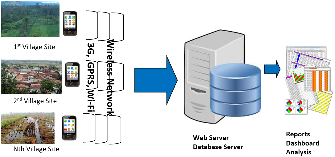
The client mobile application is designed for ease of use and data entry is done through drop-down selections and easy navigation with data validations. Thus the data for each transaction including capturing three photographs can be completed in about 40-50 seconds.
The data is uploaded to the server through a web service and is then inserted into the database in structured tables. The photographs are stored on the server hard disk. The weigh bridge data can also be uploaded to the server and stored in the database through administrator login ID for reconciliation with the Gate transaction. Further, this near real-time data can also be compared with ERP data. These reports can be exported into Excel and PDF files for archival and presentation purposes. Every report is also searchable dynamically through text search in the grid control. This flexible grid view allows users to sort/search/paginate on any data type column.
4.1. Android Client Application
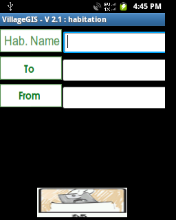
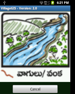
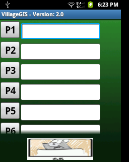
The Android client application consists of the following screens for capturing the village GIS data. The interface has been developed in local vernacular language for easy reading and identification of functionality along with icons.
5.Compelling Benefits
The Mobile application is designed for ease of use, user-friendliness and is very intuitive with relevant graphic images and screen navigation with menu options, access control permissions and automatic uploading whenever connectivity is available. It is designed for minimal human intervention and ensures that accurate and relevant data is captured as fast as possible.
- Eliminates paper based forms data capture
- Eliminates manual and redundant data entry
- Streamlines and highly improves data capturing process making use of the mobile device capabilities such as camera, GPS, SMS, internet connectivity, storage etc.
- All photographs are watermarked with Latitude and Longitude along with camp ID and Date-time stamp for easy identification.
- Centralized dashboard allows corporate executives and team leads to monitor and analyze data on a daily basis through internet anywhere, anytime.
- The overall solution is highly scalable and can handle capture from multiple devices and is designed to work even in low-connectivity remote areas through offline and online support.
- Instant alerts through SMS and e-mail can also be provided to take immediate actions on transactions that are suspicious and abnormal